

Show all photos
Back
Vlasinsko jezero
Share this attraction
Back
Vlasinsko jezero
Vranje
Vlasina Lake - the most important information
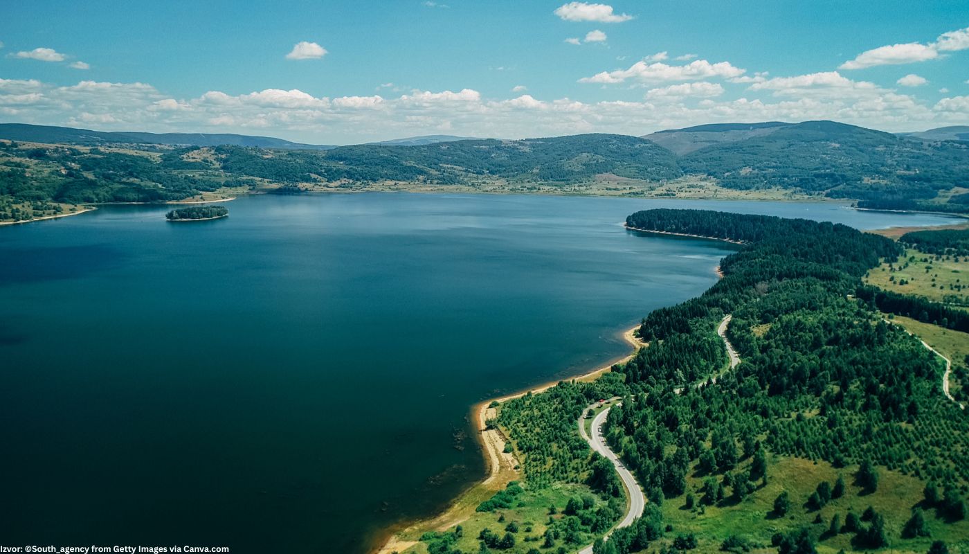
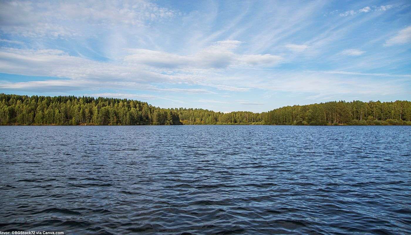
Welcome to Vlasin Lake! This reservoir is located in southeast Serbia and was formed from 1949 to 1954. Its surface is 15 km², while its depth reaches 35 meters. Lake Vlasin is located in the municipality of Surdulica. There are 3 villages on this lake's banks: Vlasina Okruglica, Vlasina Rid, and Vlasina Stojkovićeva.
How was Vlasina Lake formed?
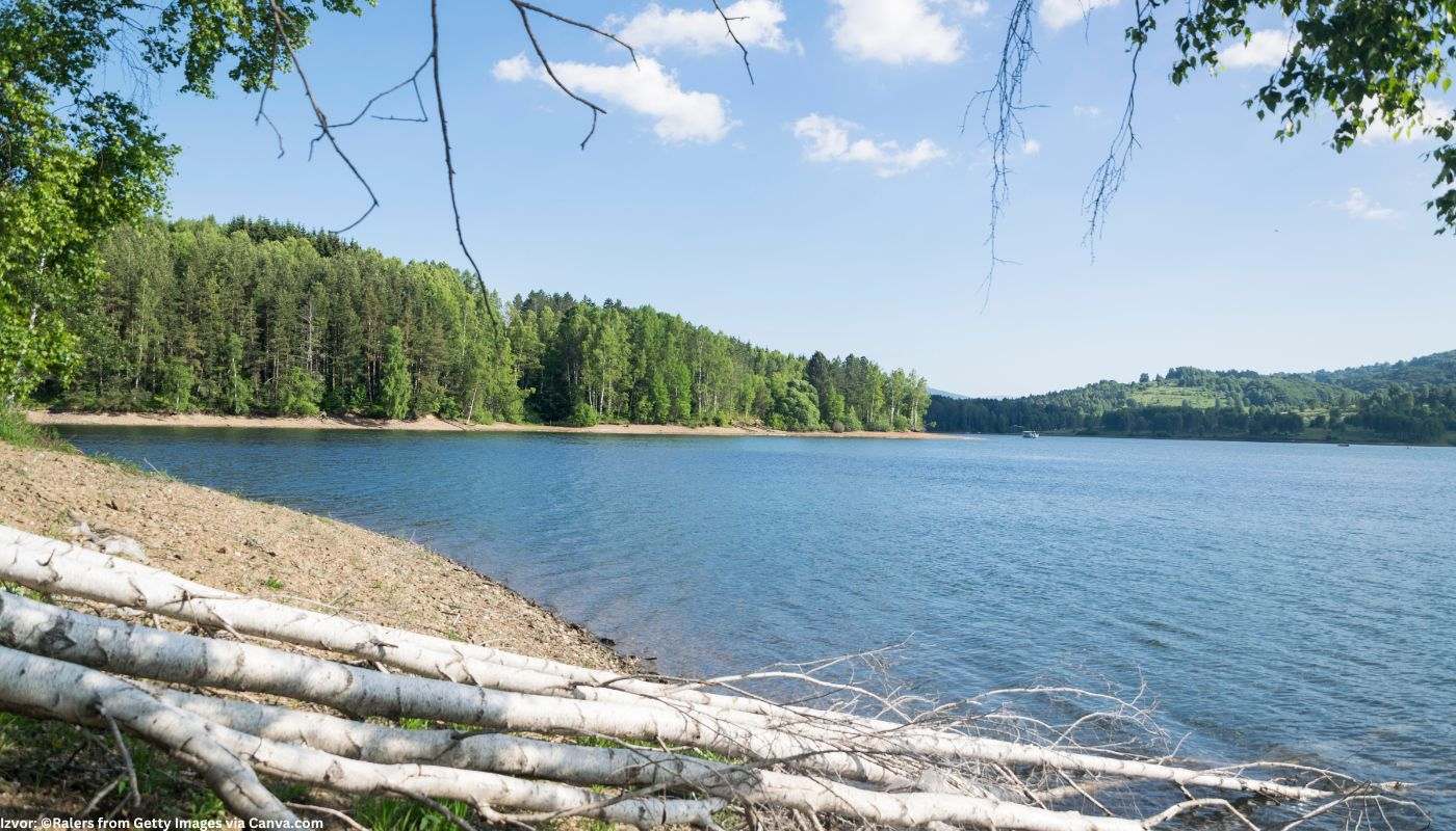
Once upon a time, there was a swamp, better known as Vlasinska blato, on the site of the Vlasina Lake, with sedge, reeds, and occasional water bodies, from which the Vlasina River flowed. The construction of the lake dam lasted from 1946 to 1949. Lake Vlasina began to fill on April 9, 1949, and reached its total capacity (165 million cubic meters of water) in 1954. The color of the water in the lake varies from gray-blue near the shore to dark blue in the middle. Vlasin Lake has 2 "permanent or immobile" islands - Stratorija and Dugi del. It is also known for its floating islands, which have changed their position over time, and were created from the underwater plant life that grew on the peat. On some islands, you can see willows and birches, trees characteristic of this area.
Legends about Vlasin Lake
The legends about the creature that hides in this place further contribute to this lake's mystique. According to the legends of people from the surrounding villages, a black bull skillfully hid in the muddy water area and managed to eat all the stray herds in its vicinity. It is believed that this creature screamed from the depths of the water before the great tragedies that befell Serbia and the world, and so the water and the earth shook from its voice before the great wars. There is also the story of Ruza, a cow seduced by the shepherd and prevented from noticing that the islet she was grazing on had separated and joined other floating lakes. Grandpa Živko searched for her for half a day and night and returned to his home disappointed, but to his amazement and joy, he saw her alive and well on a floating island the next day.
How to get to Vlasin Lake?
The best way to get to the lake is with your vehicle, either from the direction of Vranje, Vlasoticin, or Pirot. State roads leading to the lake are 231 and 40.
How was Vlasina Lake formed?
Once upon a time, there was a swamp, better known as Vlasinska blato, on the site of the Vlasina Lake, with sedge, reeds, and occasional water bodies, from which the Vlasina River flowed. The construction of the lake dam lasted from 1946 to 1949. Lake Vlasina began to fill on April 9, 1949, and reached its total capacity (165 million cubic meters of water) in 1954. The color of the water in the lake varies from gray-blue near the shore to dark blue in the middle. Vlasin Lake has 2 "permanent or immobile" islands - Stratorija and Dugi del. It is also known for its floating islands, which have changed their position over time, and were created from the underwater plant life that grew on the peat. On some islands, you can see willows and birches, trees characteristic of this area.
Legends about Vlasin Lake
The legends about the creature that hides in this place further contribute to this lake's mystique. According to the legends of people from the surrounding villages, a black bull skillfully hid in the muddy water area and managed to eat all the stray herds in its vicinity. It is believed that this creature screamed from the depths of the water before the great tragedies that befell Serbia and the world, and so the water and the earth shook from its voice before the great wars. There is also the story of Ruza, a cow seduced by the shepherd and prevented from noticing that the islet she was grazing on had separated and joined other floating lakes. Grandpa Živko searched for her for half a day and night and returned to his home disappointed, but to his amazement and joy, he saw her alive and well on a floating island the next day.
How to get to Vlasin Lake?
The best way to get to the lake is with your vehicle, either from the direction of Vranje, Vlasoticin, or Pirot. State roads leading to the lake are 231 and 40.
- By car from Vranje: From the center of Vranje, take road 158 and join the A1 highway. Follow it to and through the towns of Suvi Dol, Prevalac, Vrbovo, Gramađe, and Polom, and at the Vrla bridge, switch to state road 40. Continue towards Surdulica, Ćurkovica, Bogalija, to the town of Promaja, where you can turn onto state road 231, which takes you directly to the lake.
Additional information - What to see around Vlasin Lake?
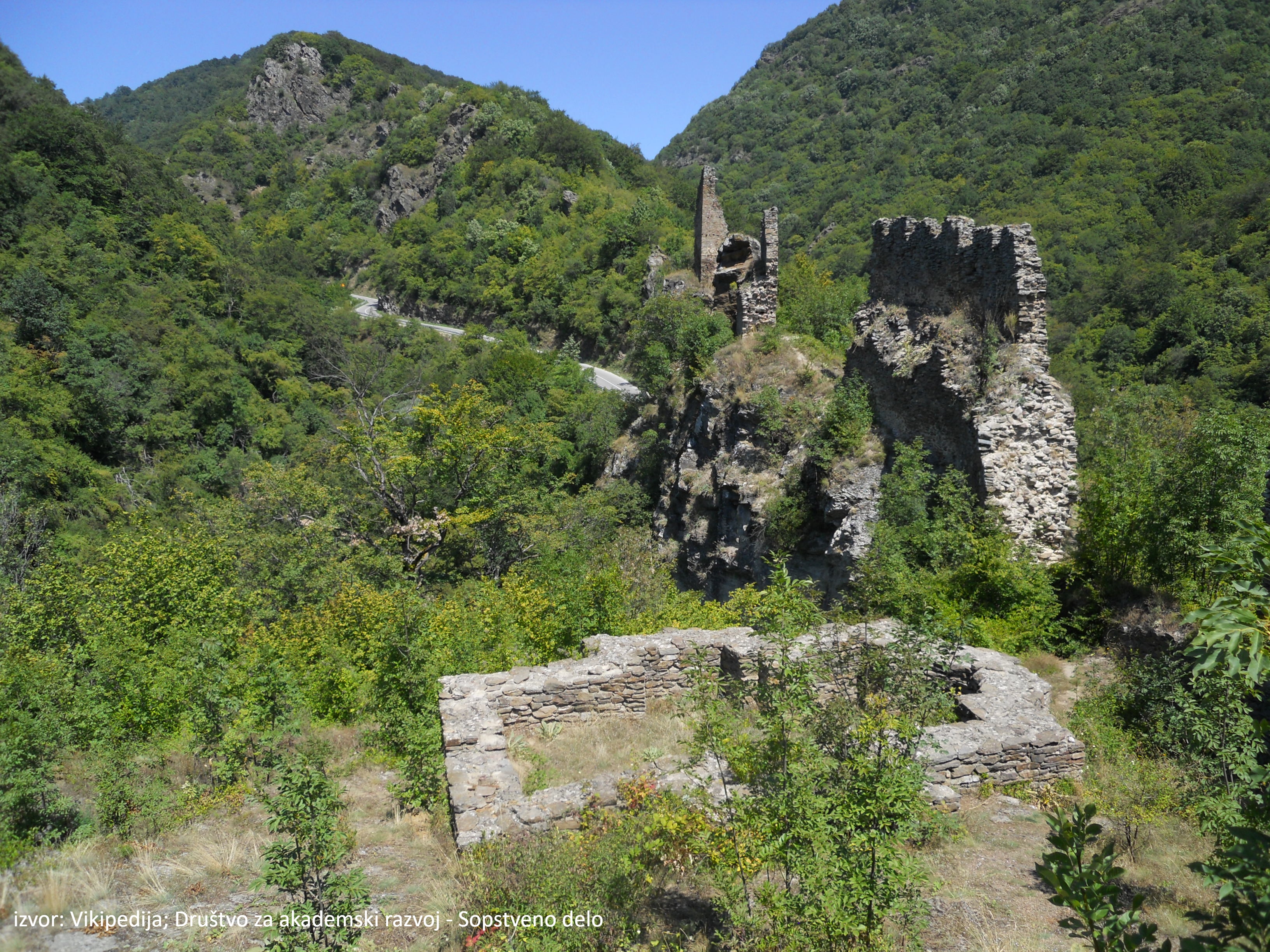
In the vicinity of Lake Vlasina, you will be able to visit important cultural monuments, such as: the monastery in Palja, the church of St. Nicholas in Crna Trava, the Kula in Klisura and the church of St. Peter the Apostle in Ruplje.
In the vicinity of Lake Vlasina, you will be able to visit important cultural monuments, such as: the monastery in Palja, the church of St. Nicholas in Crna Trava, the Kula in Klisura and the church of St. Peter the Apostle in Ruplje.
Location
More places like this


Stari hamam
Vranje

Pašin konak
Vranje

Markovo kale
Vranje


Vražji kamen
Vranje

Spomenik Staniši Stošiću
Vranje


Narodni muzej Vranje
Vranje


Manastir Prohor Pčinjski
Vranje
Find nearby accommodations


Learn more about this destination
Discover the beauty of the destination through blogs that highlight the most famous landmarks, hidden gems, and provide travel tips for visiting this destination. Embark on an adventure through the stories of experienced travelers.

Your guide to the flawless travel experience